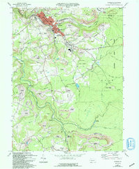
2023 Map of Windber
USGS Topo · Published 2023About this map
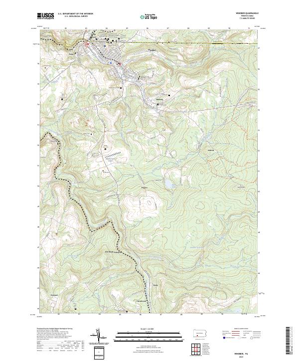
The Old Shade Furnace stands as a significant landmark along the waters of Dark Shade Creek, reflecting the industrial legacy of Somerset County. This modern survey reveals a landscape where dense cemetery groupings in Windber and Scalp Level contrast with the rugged, creek-carved terrain of the southern reaches. Numerous religious sites, including the Saints Peter and Paul Orthodox Church and Saint John Cantius Catholic Church, point to the cultural heritage of the coal-mining communities that settled here. To the east, the Windber Reservoir and the drainage of Clear Shade Creek define the high ground near Brier Knob. Smaller settlements like Ashtola, Rummel, and Cairnbrook are connected by a network of local roads and trails such as the Lost Turkey Trl, while the Alberter Farms Airport provides a small-scale aviation footprint in the central valley.
Find a feature on this map
128 named features on this map. Tap any name to fly to it.
Don’t see what you’re looking for? This feature index may not catch every label — zoom into the map to look around manually.
Map Details
Editions of this 2023 Windber Map
This is the sole edition of this map. No revisions or reprints were ever made.
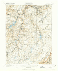
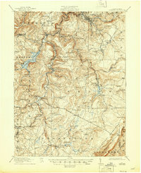
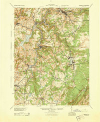
Historical Maps of Paint Township Through Time
7 maps found