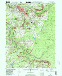
1998 Map of Windber
USGS Topo · Published 1999About this map
Windber and the surrounding borderlands of Cambria and Somerset counties are defined here by a landscape undergoing significant reclamation. Large areas of light brown tint across Paint and Shade townships indicate extensive reclaimed strip mines, signaling the shift from active extraction to land restoration in the late 20th century. The settlement pattern remains concentrated in the north around Scalp Level and Paint, where local institutions like the Windber Hospital, Library, and numerous churches, including SS Peter and Paul Ch and Holy Child Ch, serve the community.
Find a feature on this map
49 named features on this map. Tap any name to fly to it.
Don’t see what you’re looking for? This feature index may not catch every label — zoom into the map to look around manually.
Map Details
Editions of this 1998 Windber Map
This is the sole edition of this map. No revisions or reprints were ever made.
Other maps of this area

1902 · Ebensburg
USGS Topo · 1:62,500

1904 · Ebensburg
USGS Topo · 1:62,500

1904 · Johnstown
USGS Topo · 1:62,500

1907 · Johnstown
USGS Topo · 1:62,500

1908 · Bedford
USGS Topo · 1:62,500

1910 · Bedford
USGS Topo · 1:62,500

1914 · Windber
USGS Topo · 1:62,500

1916 · Windber
USGS Topo · 1:62,500

1944 · Windber
USGS Topo · 1:62,500

1953 · Pittsburgh
USGS Topo · 1:250,000