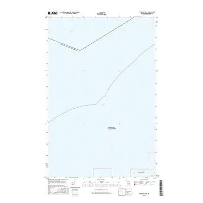
2017 Map of Windigo OE W
USGS Topo · Published 2017About this map
Lake Superior dominates this nautical and borderland survey, which focuses on the western reaches of Isle Royale National Park. The map charts the international boundary separating the United States of America from Canadian waters to the north. This is a landscape defined almost entirely by the water and the protected wilderness of the island, with very little terrestrial development or infrastructure. The inclusion of Public Land Survey System designations like t63n r39w provides a cadastral framework for the park's protected interior, while the vast expanse of the lake reflects the isolation of this maritime frontier.
Find a feature on this map
8 named features on this map. Tap any name to fly to it.
Don’t see what you’re looking for? This feature index may not catch every label — zoom into the map to look around manually.
Map Details
Editions of this 2017 Windigo OE W Map
This is the sole edition of this map. No revisions or reprints were ever made.
Other maps of this area

1958 · Hancock
USGS Topo · 1:250,000

1959 · Fort William
USGS Topo · 1:250,000

1960 · Hancock
USGS Topo · 1:250,000

1961 · Hancock
USGS Topo · 1:250,000

1966 · Hancock
USGS Topo · 1:250,000

1968 · Fort William
USGS Topo · 1:250,000

1985 · Pigeon Point
USGS Topo · 1:100,000

1985 · Grand Portage
USGS Topo · 1:100,000
1985 · Feldtmann Lake
USGS Topo · 1:24,000
1985 · Windigo
USGS Topo · 1:24,000