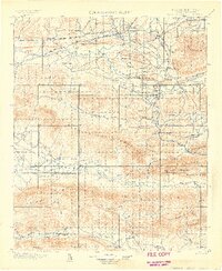
1900 Map of Winding Stair
USGS Topo · Published 1900About this map
Wister and Heavener serve as the primary junctions in this late-nineteenth-century survey of Choctaw Nation territory. The landscape is defined by the heavy presence of the railroad industry, with the Choctaw Oklahoma and Gulf R.R. and the St. Louis and San Francisco R.R. bisecting the northern plains before the land rises sharply into the massive ridges of Winding Stair Mountain and the Kiamichi Mountain.
Find a feature on this map
110 named features on this map. Tap any name to fly to it.
Don’t see what you’re looking for? This feature index may not catch every label — zoom into the map to look around manually.
Map Details
Editions of this 1900 Winding Stair Map
2 editions found
Other maps of this area

1887 · Poteau Mountain #2
USGS Topo · 1:62,500

1887 · Greenwood
USGS Topo · 1:62,500

1890 · Fort Smith
USGS Topo · 1:125,000

1890 · Poteau Mountain
USGS Topo · 1:125,000

1899 · Poteau Mountain
USGS Topo · 1:125,000

1900 · Sansbois
USGS Topo · 1:125,000

1900 · Sallisaw
USGS Topo · 1:125,000

1900 · Winding Stair
USGS Topo · 1:125,000

1901 · Tuskahoma
USGS Topo · 1:125,000

1901 · Alikchi
USGS Topo · 1:125,000