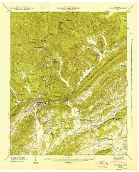
1946 Map of Windrock
USGS Topo · Published 1947About this map
Oliver Springs serves as the focal point of this mid-century landscape where the industrial and rural worlds meet at the base of Walden Ridge. The survey reveals a complex network of resource extraction and community life, anchored by the Windrock mining settlements and the prominent presence of the Southern and Louisville and Nashville railroads. These transit lines were vital for moving coal and timber from the steep slopes of Wolf Ridge and Big Fork Ridge down into the Tennessee Valley.
Find a feature on this map
90 named features on this map. Tap any name to fly to it.
Don’t see what you’re looking for? This feature index may not catch every label — zoom into the map to look around manually.
Map Details
Editions of this 1946 Windrock Map
2 editions found
Other maps of this area

1893 · Briceville
USGS Topo · 1:125,000

1895 · Loudon
USGS Topo · 1:125,000

1895 · Briceville
USGS Topo · 1:125,000

1896 · Briceville
USGS Topo · 1:125,000

1935 · Elverton
USGS Topo · 1:24,000

1935 · Bethel Valley
USGS Topo · 1:24,000

1935 · Lovell
USGS Topo · 1:24,000

1936 · Hogbell Gap
USGS Topo · 1:24,000

1936 · Duncan Flats
USGS Topo · 1:24,000

1936 · Windrock
USGS Topo · 1:24,000