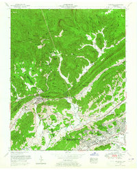
1952 Map of Windrock
USGS Topo · Published 1965About this map
Windrock Fields sit atop the high ridges of Walden Ridge, overlooking a landscape defined by the intersection of coal mining and early atomic-age development in the early 1950s. The settlement of Oliver Springs serves as a central hub where the Southern and Louisville and Nashville railroads converge, facilitating the movement of local resources. To the south, the extensive footprint of the U S Atomic Energy Commission (Oak Ridge Area) contrasts with the traditional rural life found in Dutch Valley and Frost Bottom. Numerous family cemeteries, such as Grave Hill Cemetery and Hackworth Cemetery, alongside rural congregations like Indian Creek Church, highlight the deep-rooted genealogical history of this mountain region. The transition from industrial mining at Upper Windrock to the growing suburban infrastructure of Oak Ridge is clearly visible as the region's economy shifted.
Find a feature on this map
96 named features on this map. Tap any name to fly to it.
Don’t see what you’re looking for? This feature index may not catch every label — zoom into the map to look around manually.
Map Details
Editions of this 1952 Windrock Map
2 editions found
Other maps of this area

1893 · Briceville
USGS Topo · 1:125,000

1895 · Loudon
USGS Topo · 1:125,000

1895 · Briceville
USGS Topo · 1:125,000

1896 · Briceville
USGS Topo · 1:125,000

1935 · Elverton
USGS Topo · 1:24,000

1935 · Bethel Valley
USGS Topo · 1:24,000

1935 · Lovell
USGS Topo · 1:24,000

1936 · Hogbell Gap
USGS Topo · 1:24,000

1936 · Duncan Flats
USGS Topo · 1:24,000

1936 · Windrock
USGS Topo · 1:24,000