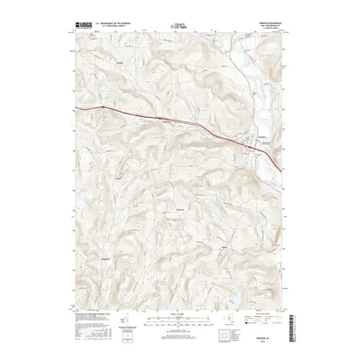
2016 Map of Windsor
USGS Topo · Published 2016About this map
The Susquehanna River carves through the eastern edge of this Broome County landscape, anchoring the village of Windsor. This 2016 survey documents a terrain defined by high ridges and narrow creek valleys, where small settlements like Occanum, Blatchley, and Lester dot the rural interior. Genealogical interest is particularly high here, with numerous burial grounds preserved across the townships, including the Windsor Village Cem, Riverside Cem, and the family-associated Riley Farm Cem.
Find a feature on this map
97 named features on this map. Tap any name to fly to it.
Don’t see what you’re looking for? This feature index may not catch every label — zoom into the map to look around manually.
Map Details
Editions of this 2016 Windsor Map
This is the sole edition of this map. No revisions or reprints were ever made.
Other maps of this area

1904 · Binghamton
USGS Topo · 1:62,500

1905 · Nineveh
USGS Topo · 1:62,500

1932 · Susquehanna
USGS Topo · 1:62,500

1935 · Chenango Forks
USGS Topo · 1:24,000

1935 · Susquehanna
USGS Topo · 1:62,500

1937 · Binghamton East
USGS Topo · 1:24,000

1942 · Chenango Forks
USGS Topo · 1:31,680

1942 · Binghamton East
USGS Topo · 1:31,680

1943 · Montrose
USGS Topo · 1:62,500

1945 · Montrose
USGS Topo · 1:62,500