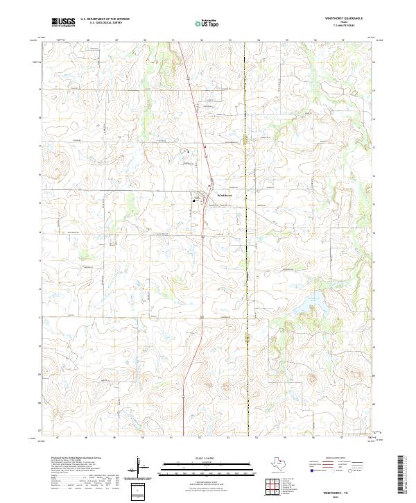
2022 Map of Windthorst
USGS Topo · Published 2022About this map
Windthorst sits at the heart of this North Texas survey, where the rolling plains of the Red River valley meet a structured grid of rural roads and homesteads. The landscape is defined by the branching drainage of W Little Post Oak Cr and E Little Post Oak Cr, with the prominent Windthorst Lake providing a significant water feature to the east. This area is characterized by deep-rooted German-Texan heritage, evident in the cluster of family-named roads such as Weinzappel Loop, Pennartz Rd, and Munchrath Rd that radiate from the town center.
Find a feature on this map
43 named features on this map. Tap any name to fly to it.
Don’t see what you’re looking for? This feature index may not catch every label — zoom into the map to look around manually.
Map Details
Editions of this 2022 Windthorst Map
This is the sole edition of this map. No revisions or reprints were ever made.
Other maps of this area

1931 · Archer City
USGS Topo · 1:62,500

1954 · Wichita Falls
USGS Topo · 1:250,000

1958 · Wichita Falls
USGS Topo · 1:250,000

1962 · Windthorst
USGS Topo · 1:24,000

1962 · Antelope Creek NE
USGS Topo · 1:24,000

1963 · Deer Creek
USGS Topo · 1:24,000

1963 · Scotland
USGS Topo · 1:24,000
1963 · Archer City NE
USGS Topo · 1:24,000

1963 · Archer City East
USGS Topo · 1:24,000

1964 · Darnell Branch
USGS Topo · 1:24,000