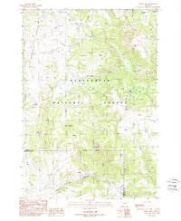
1988 Map of Windy Hill
USGS Topo · Published 1988About this map
Beaverhead National Forest defines the high-country character of this 1980s topographic study, where the Gravelly Range gives way to a complex network of drainages and peaks. The map detail highlights the hydrological importance of the region, featuring the headwaters of the Elk River and the meandering course of the Madison River along the southern boundary. Distinctive geological formations like Crater Ridge and Lobo Mesa rise above the timberline, while high-altitude water bodies such as Blue Lake and Fault Lake mark the glaciated terrain.
Find a feature on this map
32 named features on this map. Tap any name to fly to it.
Don’t see what you’re looking for? This feature index may not catch every label — zoom into the map to look around manually.
Map Details
Editions of this 1988 Windy Hill Map
This is the sole edition of this map. No revisions or reprints were ever made.
Other maps of this area

1950 · Cliff Lake
USGS Topo · 1:62,500

1950 · Lower Red Rock Lake
USGS Topo · 1:62,500

1950 · Monument Ridge
USGS Topo · 1:62,500

1950 · Upper Red Rock Lake
USGS Topo · 1:62,500

1955 · Ashton
USGS Topo · 1:250,000

1958 · Ashton
USGS Topo · 1:250,000

1960 · Ashton
USGS Topo · 1:250,000
1988 · Granite Mountain
USGS Topo · 1:24,000
1988 · Bighorn Mountain
USGS Topo · 1:24,000
1988 · Eureka Basin
USGS Topo · 1:24,000