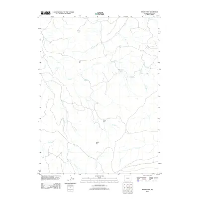
2012 Map of Windy Point
USGS Topo · Published 2012About this map
Windy Point and the high plateaus of Lincoln County define this landscape of high-altitude drainages and water management. The terrain is characterized by prominent elevations such as Bridger Hill and High Top, which oversee a complex network of seasonal and perennial waterways including Bridger Cr and Collett Cr. A series of specialized water storage sites are distributed across the quadrangle, including the uniquely named Question Mark Reservoir, White Rock Pit Reservoir, and Cercocapia Reservoir. These features, alongside Bridger Basin, reflect the area's essential relationship with water resources in a semi-arid environment, where named reservoirs such as Lag Reservoir and Pocket Reservoir serve as critical landmarks for local land use and navigation.
Find a feature on this map
17 named features on this map. Tap any name to fly to it.
Don’t see what you’re looking for? This feature index may not catch every label — zoom into the map to look around manually.
Map Details
Editions of this 2012 Windy Point Map
This is the sole edition of this map. No revisions or reprints were ever made.
Other maps of this area

1912 · Randolph
USGS Topo · 1:125,000

1954 · Sage
USGS Topo · 1:62,500

1954 · Ogden
USGS Topo · 1:250,000

1958 · Ogden
USGS Topo · 1:250,000

1960 · Ogden
USGS Topo · 1:250,000

1962 · Bell Butte NE
USGS Topo · 1:24,000

1962 · Sawtooth Mountain
USGS Topo · 1:24,000

1962 · Windy Point
USGS Topo · 1:24,000

1962 · Bell Butte
USGS Topo · 1:24,000

1968 · Rex Peak
USGS Topo · 1:24,000