
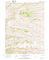
1962 Map of Bell Butte NE
USGS Topo · Published 1965About this map
Bear River Divide defines the drainage patterns of this high-elevation landscape in Lincoln County, where high ridges and complex creek systems dominate the topography. To the north, Fossil Ridge and Elk Mtn overlook a network of seasonal and perennial waters including Clear Creek and Bridger Fork. The map documents a specific environmental state in the early 1960s, showing how the land is dissected by drainages like Little Muddy Creek and Chicken Creek. Settlement is minimal, represented by features like Road Hollow, reflecting a region primarily shaped by its natural hydrology and the high-altitude divide between major river basins. The detailed contour work captures the steep transitions between the ridges and the valley floors of Carter Creek and the forks of Pine Hollow Creek.
Find a feature on this map
14 named features on this map. Tap any name to fly to it.
Don’t see what you’re looking for? This feature index may not catch every label — zoom into the map to look around manually.
Map Details
Editions of this 1962 Bell Butte NE Map
2 editions found
Other maps of this area

1954 · Sage
USGS Topo · 1:62,500

1954 · Ogden
USGS Topo · 1:250,000

1954 · Kemmerer
USGS Topo · 1:62,500

1958 · Ogden
USGS Topo · 1:250,000

1960 · Ogden
USGS Topo · 1:250,000

1962 · Sawtooth Mountain
USGS Topo · 1:24,000

1962 · Elkol SW
USGS Topo · 1:24,000

1962 · Windy Point
USGS Topo · 1:24,000

1962 · Warfield Creek
USGS Topo · 1:24,000

1962 · Bell Butte
USGS Topo · 1:24,000