
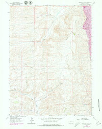
1962 Map of Warfield Creek
USGS Topo · Published 1965About this map
Bear River Divide defines the high-altitude landscape of this Wyoming region, separating the drainage of the Bear River from the tributaries of the Green River system. Recorded during a 1961 aerial survey, the map shows a landscape transitioning from traditional ranching to extractive industry. Evidence of the area's geological history and early economic activity is found at Cavanaugh Peak and the Fossil No 1 site. The human footprint is sparse but specific, centered on the Old Dutch John Ranch and various mining operations, including a Strip Mine and scattered prospect pits. Water sources remain the primary orientation points for navigation, with Warfield Springs and the South Fork Twin Creek cutting through the terrain. The network of unimproved roads and a Jeep Trail suggests a remote, working landscape used by ranchers and miners in the early 1960s.
Find a feature on this map
20 named features on this map. Tap any name to fly to it.
Don’t see what you’re looking for? This feature index may not catch every label — zoom into the map to look around manually.
Map Details
Editions of this 1962 Warfield Creek Map
2 editions found
Other maps of this area

1954 · Sage
USGS Topo · 1:62,500

1954 · Ogden
USGS Topo · 1:250,000

1954 · Kemmerer
USGS Topo · 1:62,500

1958 · Ogden
USGS Topo · 1:250,000

1960 · Ogden
USGS Topo · 1:250,000

1962 · Bell Butte NE
USGS Topo · 1:24,000

1962 · Cumberland Gap
USGS Topo · 1:24,000

1962 · Elkol SW
USGS Topo · 1:24,000

1962 · Elkol
USGS Topo · 1:24,000

1962 · Bell Butte
USGS Topo · 1:24,000