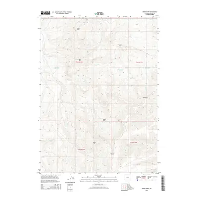
2015 Map of Windy Point
USGS Topo · Published 2015About this map
Windy Point stands as a prominent landmark in this high-altitude corner of Lincoln County, where the topography is defined by the massive Bear River Divide. This 2015 survey reveals a landscape engineered for water management in an arid environment, characterized by numerous named catchments such as Question Mark Reservoir, Cercocapia Reservoir, and White Rock Pit Reservoir. The terrain is a complex arrangement of ridges and basins, with Sillem Ridge in the north and the expansive Bridger Basin occupying the central reaches.
Find a feature on this map
24 named features on this map. Tap any name to fly to it.
Don’t see what you’re looking for? This feature index may not catch every label — zoom into the map to look around manually.
Map Details
Editions of this 2015 Windy Point Map
This is the sole edition of this map. No revisions or reprints were ever made.
Other maps of this area

1912 · Randolph
USGS Topo · 1:125,000

1954 · Sage
USGS Topo · 1:62,500

1954 · Ogden
USGS Topo · 1:250,000

1958 · Ogden
USGS Topo · 1:250,000

1960 · Ogden
USGS Topo · 1:250,000

1962 · Bell Butte NE
USGS Topo · 1:24,000

1962 · Sawtooth Mountain
USGS Topo · 1:24,000

1962 · Windy Point
USGS Topo · 1:24,000

1962 · Bell Butte
USGS Topo · 1:24,000

1968 · Rex Peak
USGS Topo · 1:24,000