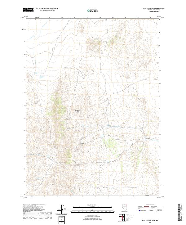
2021 Map of Wine Cup Ranch SW
USGS Topo · Published 2021About this map
The Windermere Hills dominate this high-desert landscape in northeast Nevada, where water sources are the primary indicators of human and livestock movement. Reliable water remains the central theme of the terrain, as evidenced by a concentration of named springs like Prather Springs, Brush Creek Springs, and Thurston Spring which provide life to the drainage networks of Medicine Cr and Cricket Cr. This modern survey reveals how the physical geography, characterized by high points like Black Mtn and the strategic Tripon Pass, continues to dictate the local transit patterns through features such as Sheep Draw and Hunter Draw. The map meticulously records the complex drainage system of the Great Basin, including the upper reaches of Brush Cr and the descriptively named Deathman Cr.
Find a feature on this map
21 named features on this map. Tap any name to fly to it.
Don’t see what you’re looking for? This feature index may not catch every label — zoom into the map to look around manually.
Map Details
Editions of this 2021 Wine Cup Ranch SW Map
This is the sole edition of this map. No revisions or reprints were ever made.
Other maps of this area

1955 · Wells
USGS Topo · 1:250,000

1958 · Wells
USGS Topo · 1:250,000

1961 · Wells
USGS Topo · 1:250,000

1968 · Wilkins
USGS Topo · 1:24,000

1968 · Holborn
USGS Topo · 1:24,000

1968 · Melandco
USGS Topo · 1:24,000

1968 · Pequop
USGS Topo · 1:24,000

1968 · Wells Peak
USGS Topo · 1:24,000

1968 · Wine Cup Ranch SE
USGS Topo · 1:24,000

1968 · Wine Cup Ranch
USGS Topo · 1:24,000