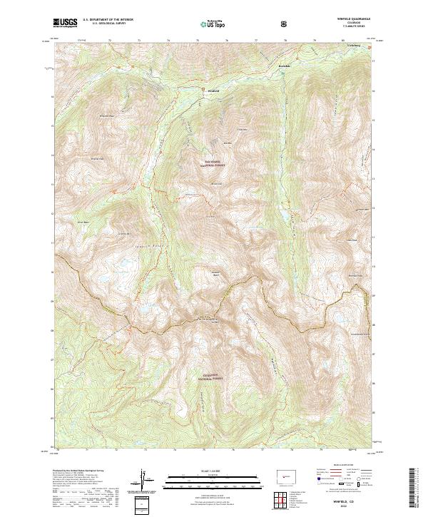
2022 Map of Winfield
USGS Topo · Published 2022About this map
The Sawatch Range defines this high-altitude landscape along the border of Chaffee and Gunnison counties. Centered on the settlement of Winfield, this 2022 survey captures a terrain dominated by fourteeners and significant alpine drainages. The historic mining era remains visible through the placement of Rockdale and Vicksburg along the banks of Clear Creek. The map provides a detailed network of high-country trails, including the Continental Divide National Scenic Trail and paths leading to formidable summits like Huron Peak and Missouri Mountain. Alpine water bodies such as Lake Ann, Clohesy Lake, and Pear Lake are scattered through the glacial basins. This modern topographic record reflects the dual legacy of the area as both a site of 19th-century mineral extraction and a contemporary protected wilderness within the San Isabel and Gunnison National Forests.
Find a feature on this map
62 named features on this map. Tap any name to fly to it.
Don’t see what you’re looking for? This feature index may not catch every label — zoom into the map to look around manually.
Map Details
Editions of this 2022 Winfield Map
This is the sole edition of this map. No revisions or reprints were ever made.
Other maps of this area

1889 · Leadville
USGS Topo · 1:125,000

1891 · Leadville
USGS Topo · 1:125,000

1909 · Mount Jackson
USGS Topo · 1:125,000

1911 · Mount Jackson
USGS Topo · 1:125,000

1934 · Taylor Park
USGS Topo · 1:62,500

1935 · Mount Elbert
USGS Topo · 1:62,500

1937 · Taylor Park
USGS Topo · 1:62,500

1938 · Mount Elbert
USGS Topo · 1:62,500

1939 · Mount Elbert
USGS Topo · 1:62,500

1942 · Leadville
USGS Topo · 1:125,000