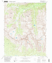
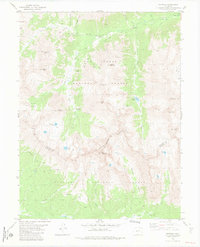
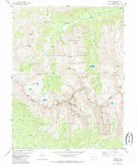
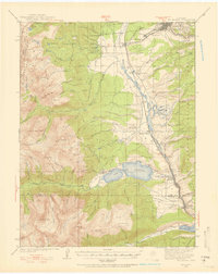
1982 Map of Winfield
USGS Topo · Published 1985About this map
Winfield and Vicksburg sit at the northern edge of this high-altitude survey, marking the historic mining activity along Clear Creek. The landscape is defined by the Continental Divide and the meeting of San Isabel National Forest and Gunnison National Forest. Local history is anchored by mining relics such as the Banker Mine and smaller nameless Mines scattered across the steep gulches. These operations relied on a network of Pack Trails and Jeep Trails that navigate the high passes between Huron Peak and the striking formation known as The Three Apostles.
Find a feature on this map
53 named features on this map. Tap any name to fly to it.
Don’t see what you’re looking for? This feature index may not catch every label — zoom into the map to look around manually.
Map Details
Editions of this 1982 Winfield Map
3 editions found
Other maps of this area

1889 · Leadville
USGS Topo · 1:125,000

1891 · Leadville
USGS Topo · 1:125,000

1909 · Mount Jackson
USGS Topo · 1:125,000

1911 · Mount Jackson
USGS Topo · 1:125,000
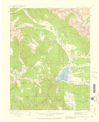
1934 · Taylor Park
USGS Topo · 1:62,500
1935 · Mount Elbert
USGS Topo · 1:62,500
1937 · Taylor Park
USGS Topo · 1:62,500

1938 · Mount Elbert
USGS Topo · 1:62,500

1939 · Mount Elbert
USGS Topo · 1:62,500

1942 · Leadville
USGS Topo · 1:125,000