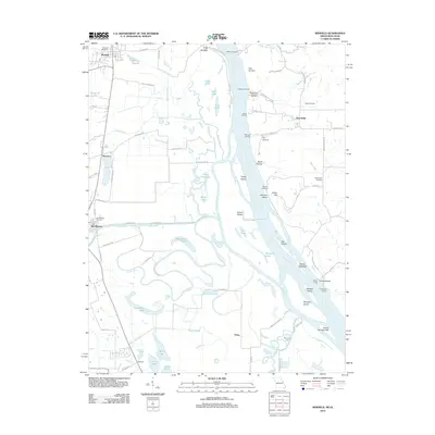
2012 Map of Winfield
USGS Topo · Published 2012About this map
The Cave In and Indian Hill overlook a complex network of backwaters and islands along the Mississippi River in this 2012 study of the Missouri-Illinois border. The landscape is defined by the hydrologic meeting of the Cuivre River and the Mississippi, creating a mosaic of oxbows and sloughs such as Argent Slough, Cuivre Slough, and Fish Slough. Local industry and river access points are numerous, marked by a series of historic landings including Dogtown Landing, Beech Landing, and Poppleton Landing, alongside the West Point Ferry. On the Missouri side, the settlements of Winfield, Old Monroe, and Brevator sit above the floodplains, while the Old Monroe Mounds provide a silent record of even earlier inhabitants. Genealogists can find several burial grounds documented here, including Winfield Cemetery, Ingle Cemetery, and Minesinger Cemetery.
Find a feature on this map
87 named features on this map. Tap any name to fly to it.
Don’t see what you’re looking for? This feature index may not catch every label — zoom into the map to look around manually.
Map Details
Editions of this 2012 Winfield Map
This is the sole edition of this map. No revisions or reprints were ever made.
Other maps of this area

1903 · O'Fallon
USGS Topo · 1:125,000

1930 · Hardin
USGS Topo · 1:62,500

1931 · Brussels
USGS Topo · 1:62,500

1934 · Elsberry
USGS Topo · 1:48,000

1934 · Hardin
USGS Topo · 1:62,500

1938 · Hardin
USGS Topo · 1:62,500

1939 · Brussels
USGS Topo · 1:62,500

1941 · Troy
USGS Topo · 1:62,500

1942 · Elsberry
USGS Topo · 1:62,500

1943 · Brussels
USGS Topo · 1:62,500