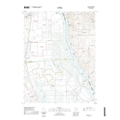
2017 Map of Winfield
USGS Topo · Published 2017About this map
The Mississippi River forms the central spine of this landscape, separating the bottomlands of Lincoln Co and St. Charles Co in Missouri from Calhoun Co in Illinois. This riverine environment is defined by a complex network of sloughs and side channels, including the Cuivre Canal and the winding Argent Slough. Along the western bluffs and plains, the settlements of Winfield and Old Monroe anchor the region, while the eastern Illinois bank shows a more isolated character near Beechville and the landing at The Cave In.
Find a feature on this map
92 named features on this map. Tap any name to fly to it.
Don’t see what you’re looking for? This feature index may not catch every label — zoom into the map to look around manually.
Map Details
Editions of this 2017 Winfield Map
This is the sole edition of this map. No revisions or reprints were ever made.
Other maps of this area

1903 · O'Fallon
USGS Topo · 1:125,000

1930 · Hardin
USGS Topo · 1:62,500

1931 · Brussels
USGS Topo · 1:62,500

1934 · Elsberry
USGS Topo · 1:48,000

1934 · Hardin
USGS Topo · 1:62,500

1938 · Hardin
USGS Topo · 1:62,500

1939 · Brussels
USGS Topo · 1:62,500

1941 · Troy
USGS Topo · 1:62,500

1942 · Elsberry
USGS Topo · 1:62,500

1943 · Brussels
USGS Topo · 1:62,500