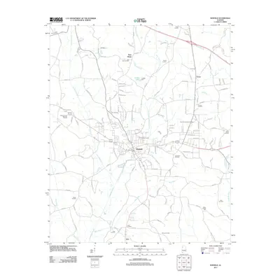
2011 Map of Winfield
USGS Topo · Published 2011About this map
Winfield serves as the central hub for this portion of Alabama, characterized by the winding path of Luxapallila Creek and its numerous tributaries. The landscape is dotted with small rural communities and family-named locations, including New Hope to the north and Bobo to the south. Local heritage is preserved in a high concentration of burial sites, ranging from the large Winfield City Cemetery and Marion County Memorial Gardens to smaller, family-oriented grounds like the Riley Baccus Family Cemetery. The region's industrial footprint is represented by the Happy Hill Gas Field and water management features such as Holt Dam and Langley Dam. A dense network of county roads, such as Co Hwy-52 and Co Hwy-47, connects these scattered settlements, illustrating the area's development as an interconnected rural and small-town corridor.
Find a feature on this map
151 named features on this map. Tap any name to fly to it.
Don’t see what you’re looking for? This feature index may not catch every label — zoom into the map to look around manually.
Map Details
Editions of this 2011 Winfield Map
This is the sole edition of this map. No revisions or reprints were ever made.
Other maps of this area

1953 · Birmingham
USGS Topo · 1:250,000

1956 · Birmingham
USGS Topo · 1:250,000

1956 · Gadsden
USGS Topo · 1:250,000

1957 · Birmingham
USGS Topo · 1:250,000

1958 · Gadsden
USGS Topo · 1:250,000

1958 · Gold Mine
USGS Topo · 1:24,000

1960 · Gadsden
USGS Topo · 1:250,000

1963 · Gadsden
USGS Topo · 1:250,000

1967 · Winfield SE
USGS Topo · 1:24,000

1967 · Hubbertville
USGS Topo · 1:24,000