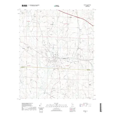
2018 Map of Winfield
USGS Topo · Published 2018About this map
Luxapallila Creek and its various branches, including the East Branch, carve a complex drainage pattern across the border of Marion and Fayette counties. This 2018 edition reveals the late-modern landscape of Winfield, where the town center is surrounded by numerous burial grounds and memorial sites that reflect generations of local history. From the Winfield City Cemetery to smaller family plots like the Riley Baccus Family Cemetery, the map serves as a vital record for genealogical research in north-central Alabama.
Find a feature on this map
172 named features on this map. Tap any name to fly to it.
Don’t see what you’re looking for? This feature index may not catch every label — zoom into the map to look around manually.
Map Details
Editions of this 2018 Winfield Map
This is the sole edition of this map. No revisions or reprints were ever made.
Other maps of this area

1953 · Birmingham
USGS Topo · 1:250,000

1956 · Birmingham
USGS Topo · 1:250,000

1956 · Gadsden
USGS Topo · 1:250,000

1957 · Birmingham
USGS Topo · 1:250,000

1958 · Gadsden
USGS Topo · 1:250,000

1958 · Gold Mine
USGS Topo · 1:24,000

1960 · Gadsden
USGS Topo · 1:250,000

1963 · Gadsden
USGS Topo · 1:250,000

1967 · Winfield SE
USGS Topo · 1:24,000

1967 · Hubbertville
USGS Topo · 1:24,000