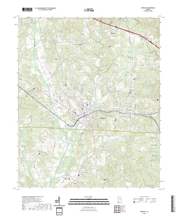
2024 Map of Winfield
USGS Topo · Published 2024About this map
Winfield serves as the central hub of this North Alabama landscape, situated where the Marion Co Fayette Co line divides the terrain. The area is defined by a dense network of country roads and small communities such as Brilliant, Tucker, Twin, and Glen Allen. Waterways like Luxapallila Creek and the East Branch Luxapallila Creek carve through the topography, with Langley Lake providing a significant local landmark.
Find a feature on this map
178 named features on this map. Tap any name to fly to it.
Don’t see what you’re looking for? This feature index may not catch every label — zoom into the map to look around manually.
Map Details
Editions of this 2024 Winfield Map
This is the sole edition of this map. No revisions or reprints were ever made.
Other maps of this area

1953 · Birmingham
USGS Topo · 1:250,000

1956 · Birmingham
USGS Topo · 1:250,000

1956 · Gadsden
USGS Topo · 1:250,000

1957 · Birmingham
USGS Topo · 1:250,000

1958 · Gadsden
USGS Topo · 1:250,000

1958 · Gold Mine
USGS Topo · 1:24,000

1960 · Gadsden
USGS Topo · 1:250,000

1963 · Gadsden
USGS Topo · 1:250,000

1967 · Winfield SE
USGS Topo · 1:24,000

1967 · Hubbertville
USGS Topo · 1:24,000