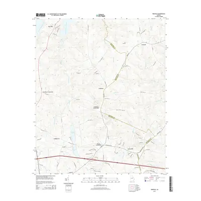
2014 Map of Winfield
USGS Topo · Published 2014About this map
Stones Crossroads and Cobbham Crossroads serve as central nodes for a landscape defined by small settlements and winding creek drainages in east-central Georgia. The map depicts a transitional terrain where the waters of the J. Strom Thurmond Reservoir reach into the northwestern corner, contrasting with the dense network of interior streams such as Germany Cr, Rousseau Cr, and Greenbrier Cr. Genealogists and local historians will find value in the specific locations of the Collins Cemetery and the industrial site of Ansley Mill near the southern boundary. The area's transit history is preserved through labels for the Stagecoach Road and several family-named crossroads like Hamilton Crossroads, indicating long-established rural connections. Private water features like Harrison Lake A and Harrison Lake B further illustrate the land-use patterns of this region near the border of Columbia and McDuffie counties.
Find a feature on this map
76 named features on this map. Tap any name to fly to it.
Don’t see what you’re looking for? This feature index may not catch every label — zoom into the map to look around manually.
Map Details
Editions of this 2014 Winfield Map
This is the sole edition of this map. No revisions or reprints were ever made.
Other maps of this area

1892 · Mc Cormick
USGS Topo · 1:125,000

1906 · Crawfordville
USGS Topo · 1:125,000

1912 · Mc Cormick
USGS Topo · 1:125,000

1921 · Appling
USGS Topo · 1:62,500

1922 · Harlem
USGS Topo · 1:62,500

1943 · Appling
USGS Topo · 1:62,500

1948 · Harlem
USGS Topo · 1:62,500

1948 · Harlem
USGS Topo · 1:24,000

1948 · Thomson East
USGS Topo · 1:24,000

1950 · Dearing
USGS Topo · 1:24,000