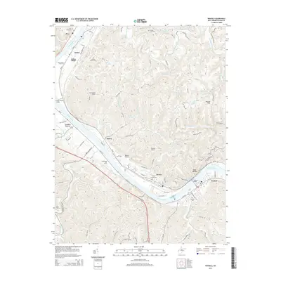
2014 Map of Winfield
USGS Topo · Published 2014About this map
Winfield Bridge and the Winfield Locks and Dam anchor this 2014 survey of the Kanawha River valley. The map documents a corridor of West Virginia river towns including Buffalo, Eleanor, and the county seat at Winfield. These settlements are linked by the CSX rail line and a network of county roads that navigate the complex drainage patterns of Hurricane Creek and Eighteenmile Creek. Local history and genealogy interests are well-represented by several family and community burial grounds, such as Shiloh Cem, Giles Stern Cem, and the Buffalo Memorial Park. The landscape transitions from the river bottomlands, home to sites like the Meadowland Golf Course, to the steep drainages of Tacoma Hollow and Pleasant Ridge, reflecting the area's characteristic Appalachian topography.
Find a feature on this map
90 named features on this map. Tap any name to fly to it.
Don’t see what you’re looking for? This feature index may not catch every label — zoom into the map to look around manually.
Map Details
Editions of this 2014 Winfield Map
This is the sole edition of this map. No revisions or reprints were ever made.
Other maps of this area

1892 · Huntington
USGS Topo · 1:125,000

1898 · Huntington
USGS Topo · 1:125,000

1899 · Charleston
USGS Topo · 1:125,000

1902 · Milton
USGS Topo · 1:62,500

1906 · Glenwood
USGS Topo · 1:62,500

1906 · Winfield
USGS Topo · 1:62,500

1908 · Glenwood
USGS Topo · 1:62,500

1908 · Winfield
USGS Topo · 1:62,500

1909 · Saint Albans
USGS Topo · 1:62,500

1931 · Saint Albans
USGS Topo · 1:62,500