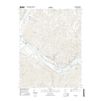
2016 Map of Winfield
USGS Topo · Published 2016About this map
The Kanawha River dictates the settlement pattern and industry of this Putnam County region, where the Winfield Locks and Dam serves as a critical maritime infrastructure point. Along the banks, established communities like Winfield, Buffalo, and Eleanor are linked by a network of river-road corridors including Winfield Rd and Buffalo Rd. The topographic data reveals a landscape defined by sharp ridges such as Luikart Ridge and Cross Creek Ridge, separated by numerous hollows and creek beds that feed into the main waterway.
Find a feature on this map
119 named features on this map. Tap any name to fly to it.
Don’t see what you’re looking for? This feature index may not catch every label — zoom into the map to look around manually.
Map Details
Editions of this 2016 Winfield Map
This is the sole edition of this map. No revisions or reprints were ever made.
Other maps of this area

1892 · Huntington
USGS Topo · 1:125,000

1898 · Huntington
USGS Topo · 1:125,000

1899 · Charleston
USGS Topo · 1:125,000

1902 · Milton
USGS Topo · 1:62,500

1906 · Glenwood
USGS Topo · 1:62,500

1906 · Winfield
USGS Topo · 1:62,500

1908 · Glenwood
USGS Topo · 1:62,500

1908 · Winfield
USGS Topo · 1:62,500

1909 · Saint Albans
USGS Topo · 1:62,500

1931 · Saint Albans
USGS Topo · 1:62,500