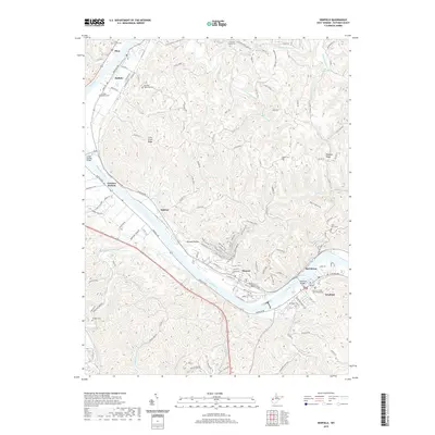
2019 Map of Winfield
USGS Topo · Published 2019About this map
The Kanawha River serves as the central artery for this Putnam County landscape, where the county seat of Winfield sits across from Red House. The river corridor is punctuated by long-established river towns including Buffalo, Eleanor, and Pliny. The transition from the alluvial flats of the river valley to the steep ridges of the interior is marked by features like Luikart Ridge and Cross Creek Ridge. This 2019 survey documents the civic infrastructure at Winfield, including the Putnam County Judicial Building, while preserving the locations of numerous family and community burial grounds such as Giles Stern Cem, Shiloh Cem, and Hodges Cem. The upland terrain is heavily dissected by a network of runs and branches, including Jokes Run and Little Hurricane Cr, reflecting a traditional Appalachian drainage pattern that has dictated local road and settlement placement for generations.
Find a feature on this map
133 named features on this map. Tap any name to fly to it.
Don’t see what you’re looking for? This feature index may not catch every label — zoom into the map to look around manually.
Map Details
Editions of this 2019 Winfield Map
This is the sole edition of this map. No revisions or reprints were ever made.
Other maps of this area

1892 · Huntington
USGS Topo · 1:125,000

1898 · Huntington
USGS Topo · 1:125,000

1899 · Charleston
USGS Topo · 1:125,000

1902 · Milton
USGS Topo · 1:62,500

1906 · Glenwood
USGS Topo · 1:62,500

1906 · Winfield
USGS Topo · 1:62,500

1908 · Glenwood
USGS Topo · 1:62,500

1908 · Winfield
USGS Topo · 1:62,500

1909 · Saint Albans
USGS Topo · 1:62,500

1931 · Saint Albans
USGS Topo · 1:62,500