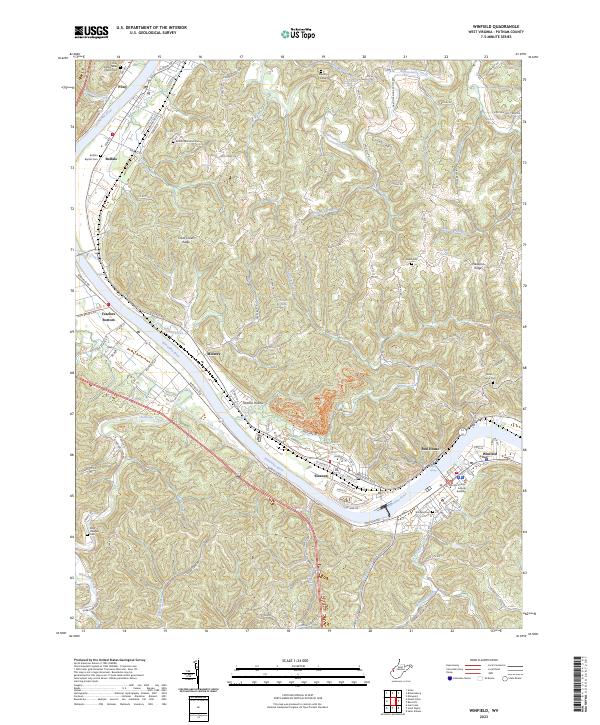
2023 Map of Winfield
USGS Topo · Published 2023About this map
The Kanawha River serves as the central artery for this portion of Putnam County, anchoring a string of historic settlements including Buffalo, Eleanor, and the county seat of Winfield. The river's influence is evident in the lowland topography of Fraziers Bottom and Midway, where the floodplain transitions into the steep, dissected ridges of Cross Creek Ridge and Luikart Ridge. This modern survey documents the persistent importance of local landmarks and family lineage, evidenced by numerous burial sites such as the Giles - Stern Cem and Shiloh Cem.
Find a feature on this map
133 named features on this map. Tap any name to fly to it.
Don’t see what you’re looking for? This feature index may not catch every label — zoom into the map to look around manually.
Map Details
Editions of this 2023 Winfield Map
This is the sole edition of this map. No revisions or reprints were ever made.
Other maps of this area

1892 · Huntington
USGS Topo · 1:125,000

1898 · Huntington
USGS Topo · 1:125,000

1899 · Charleston
USGS Topo · 1:125,000

1902 · Milton
USGS Topo · 1:62,500

1906 · Glenwood
USGS Topo · 1:62,500

1906 · Winfield
USGS Topo · 1:62,500

1908 · Glenwood
USGS Topo · 1:62,500

1908 · Winfield
USGS Topo · 1:62,500

1909 · Saint Albans
USGS Topo · 1:62,500

1931 · Saint Albans
USGS Topo · 1:62,500