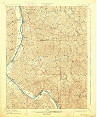
1908 Map of Winfield
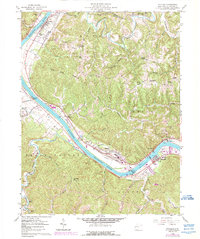
USGS Topo · Published 1927About this map
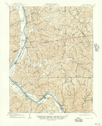
The Kanawha River serves as the central artery for this 1906 survey of Putnam and Mason counties, where the Michigan and Ohio R R tracks follow the river's eastern bank through the coal and river communities of the early twentieth century. Steamboat-era infrastructure is prominently detailed, including Lock No 10, Lock No 9, and Lock No 8, which regulated the heavy barge traffic of the era. The settlement pattern reveals riverfront hubs like Buffalo, Grimms Landing, and the county seat at Winfield, contrasted with the interior hill country settlements of Confidence and Paradise. South of the river, the unique topography of the Teays Valley appears alongside the bottomlands at Fraziers Bottom, illustrating the varied landscape between the Kanawha and the Pocatalico River. Local industrial history is noted at the riverside landing of Black Betsey and the nearby loading points of Plymouth and Bancroft.
Find a feature on this map
85 named features on this map. Tap any name to fly to it.
Don’t see what you’re looking for? This feature index may not catch every label — zoom into the map to look around manually.
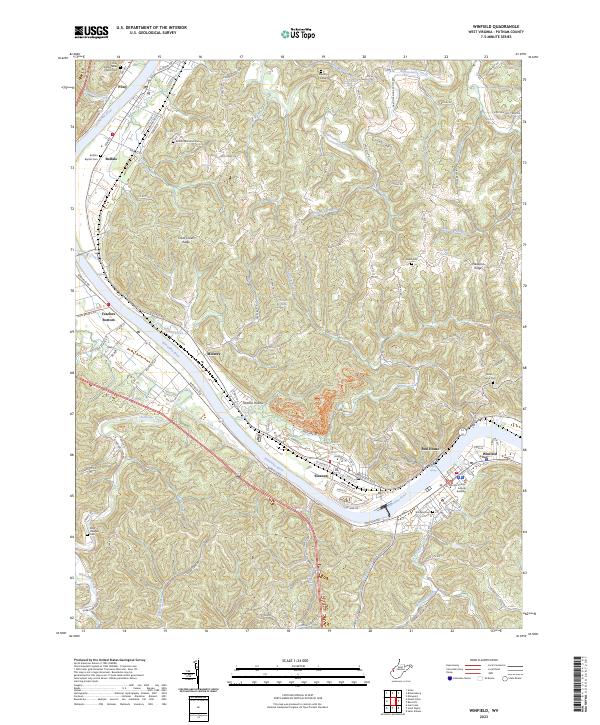
Map Details
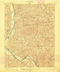
Editions of this 1908 Winfield Map
3 editions found
Historical Maps of Winfield Through Time
4 maps found