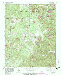
1980 Map of Winfield
USGS Topo · Published 1983About this map
Winfield serves as the central hub of this survey along the border of Tennessee and Kentucky, where the Southern railroad and Highway 27 cut through a landscape defined by coal extraction and timber. Extensive Strip Mines are visible across the hills, particularly within the Daniel Boone National Forest and near settlements like Strunk and Isham. The rugged topography is drained by a dense network of waterways, including Roaring Paunch Creek and Jellico Creek, which flow through the forested ridges.
Find a feature on this map
49 named features on this map. Tap any name to fly to it.
Don’t see what you’re looking for? This feature index may not catch every label — zoom into the map to look around manually.
Map Details
Editions of this 1980 Winfield Map
2 editions found
Other maps of this area

1890 · Williamsburg
USGS Topo · 1:125,000

1893 · Briceville
USGS Topo · 1:125,000

1894 · Williamsburg
USGS Topo · 1:125,000

1895 · Wartburg
USGS Topo · 1:125,000

1895 · Briceville
USGS Topo · 1:125,000

1896 · Wartburg
USGS Topo · 1:125,000

1896 · Briceville
USGS Topo · 1:125,000

1934 · Barthell
USGS Topo · 1:62,500

1936 · Pioneer
USGS Topo · 1:24,000
1946 · Pioneer
USGS Topo · 1:24,000