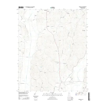
2014 Map of Winfield SE
USGS Topo · Published 2014About this map
Luxapalila Creek and Musgrove Cr carve through this section of Fayette and Marion Counties, creating a landscape defined by its riparian networks and scattered rural settlements. Just south of Winfield, the corridor along US Highway 43 connects smaller communities like Stewart and Glen Allen, where the terrain begins to rise away from the floodplain of the Sipsey River. The density of family and community burial grounds, such as Hodge Chapel Cem, Gilpin Cem, and Shirley Cem, provides a significant genealogical map of the region's heritage.
Find a feature on this map
72 named features on this map. Tap any name to fly to it.
Don’t see what you’re looking for? This feature index may not catch every label — zoom into the map to look around manually.
Map Details
Editions of this 2014 Winfield SE Map
This is the sole edition of this map. No revisions or reprints were ever made.
Other maps of this area

1953 · Birmingham
USGS Topo · 1:250,000

1956 · Birmingham
USGS Topo · 1:250,000

1957 · Birmingham
USGS Topo · 1:250,000

1967 · Bankston
USGS Topo · 1:24,000

1967 · Winfield SE
USGS Topo · 1:24,000

1967 · Hubbertville
USGS Topo · 1:24,000
1967 · Glen Allen
USGS Topo · 1:24,000

1967 · Bluff
USGS Topo · 1:24,000

1967 · Fayette
USGS Topo · 1:24,000
1967 · Winfield
USGS Topo · 1:24,000