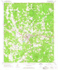
1967 Map of Winfield
USGS Topo · Published 1968About this map
Winfield serves as the focal point of this late 1960s survey, straddling the boundary between Marion and Fayette counties. The landscape is defined by the heavy presence of the St Louis San Francisco railroad, which cuts through the heart of the settlement near the Waterworks and local hospital. Rural life outside the corporate limits is anchored by numerous country churches and cemeteries, including Musgrove Chapel, Happy Hill Ch, and the Logan Cem.
Find a feature on this map
49 named features on this map. Tap any name to fly to it.
Don’t see what you’re looking for? This feature index may not catch every label — zoom into the map to look around manually.
Map Details
Editions of this 1967 Winfield Map
3 editions found
Other maps of this area

1953 · Birmingham
USGS Topo · 1:250,000

1956 · Birmingham
USGS Topo · 1:250,000

1956 · Gadsden
USGS Topo · 1:250,000

1957 · Birmingham
USGS Topo · 1:250,000

1958 · Gadsden
USGS Topo · 1:250,000

1958 · Gold Mine
USGS Topo · 1:24,000

1960 · Gadsden
USGS Topo · 1:250,000

1963 · Gadsden
USGS Topo · 1:250,000

1967 · Winfield SE
USGS Topo · 1:24,000

1967 · Hubbertville
USGS Topo · 1:24,000