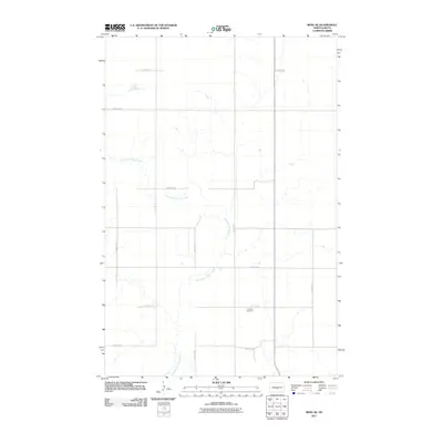
2011 Map of Wing SE
USGS Topo · Published 2011About this map
East Branch Apple Creek meanders through this portion of Burleigh County, defining a landscape primarily shaped by rural section lines and water drainage. The terrain is characterized by its organized grid of local roads, such as 201st Ave NE and 288th St NE, which serve the agricultural plots of the region. A significant landmark for genealogical research is Aholan Cemetery, located near the intersection of 201st Ave NE and 301st St NE. This site provides a focal point for local history in an otherwise open prairie environment. The map captures the quiet, rural character of North Dakota in the early 21st century, showing how the natural path of the creek interacts with the rigid human geometry of the township and range survey system.
Find a feature on this map
13 named features on this map. Tap any name to fly to it.
Don’t see what you’re looking for? This feature index may not catch every label — zoom into the map to look around manually.
Map Details
Editions of this 2011 Wing SE Map
This is the sole edition of this map. No revisions or reprints were ever made.
Other maps of this area

1951 · McKenzie
USGS Topo · 1:62,500

1951 · Driscoll
USGS Topo · 1:62,500

1954 · Bismarck
USGS Topo · 1:250,000

1954 · McClusky
USGS Topo · 1:250,000

1958 · Bismarck
USGS Topo · 1:250,000

1958 · McClusky
USGS Topo · 1:250,000

1975 · Sibley Butte
USGS Topo · 1:24,000

1975 · Wing SE
USGS Topo · 1:24,000
1975 · McKenzie NW
USGS Topo · 1:24,000
1975 · Wing SW
USGS Topo · 1:24,000