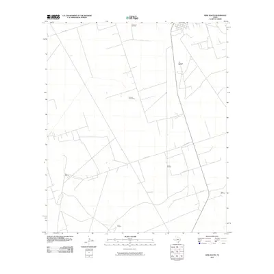
2010 Map of Wink South
USGS Topo · Published 2010About this map
The Old Brookfield Windmill and numerous other scattered landmarks define this sparsely settled stretch of West Texas ranch land south of Wink. The 2010 landscape is mapped with a focus on the essential infrastructure of the desert environment, where named water sources like Windmill Number Three and the Cattleguard Windmill serve as primary navigational waypoints across the open range.
Find a feature on this map
11 named features on this map. Tap any name to fly to it.
Don’t see what you’re looking for? This feature index may not catch every label — zoom into the map to look around manually.
Map Details
Editions of this 2010 Wink South Map
This is the sole edition of this map. No revisions or reprints were ever made.
Other maps of this area

1954 · Pecos
USGS Topo · 1:250,000

1957 · Pecos
USGS Topo · 1:250,000

1968 · Soda Lake SE
USGS Topo · 1:24,000

1968 · Wink South
USGS Topo · 1:24,000

1968 · Soda Lake NE
USGS Topo · 1:24,000

1969 · Pyote NE
USGS Topo · 1:24,000

1969 · Pyote East
USGS Topo · 1:24,000
1969 · Pyote West
USGS Topo · 1:24,000

1970 · Wink North
USGS Topo · 1:24,000

1970 · Cheyenne Draw SE
USGS Topo · 1:24,000