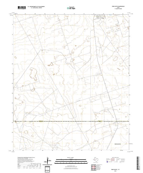
2022 Map of Wink South
USGS Topo · Published 2022About this map
Wink occupies the northern edge of this high-plains landscape, where the street grid of the town site gives way to the open terrain of the Permian Basin. The boundary between Winkler Co and Ward Co bisects the southern half of the quadrangle, a straight-line survey mark crossing the ephemeral channel of Monument Draw. In the lower southeastern corner, the outskirts of Monahans begin to emerge along the highway corridor. A network of rural and county roads, including Little Joe Rd and Co Rd 201, provides access through the scrub and sandhills typical of this West Texas region. The map reveals the relationship between these small oil-country settlements and the vast, undeveloped stretches between them, with residential streets like S Pyote Ave and S Oaklawn Dr ending abruptly at the desert's edge.
Find a feature on this map
13 named features on this map. Tap any name to fly to it.
Don’t see what you’re looking for? This feature index may not catch every label — zoom into the map to look around manually.
Map Details
Editions of this 2022 Wink South Map
This is the sole edition of this map. No revisions or reprints were ever made.
Other maps of this area

1954 · Pecos
USGS Topo · 1:250,000

1957 · Pecos
USGS Topo · 1:250,000

1968 · Soda Lake SE
USGS Topo · 1:24,000

1968 · Wink South
USGS Topo · 1:24,000

1968 · Soda Lake NE
USGS Topo · 1:24,000

1969 · Pyote NE
USGS Topo · 1:24,000

1969 · Pyote East
USGS Topo · 1:24,000
1969 · Pyote West
USGS Topo · 1:24,000

1970 · Wink North
USGS Topo · 1:24,000

1970 · Cheyenne Draw SE
USGS Topo · 1:24,000