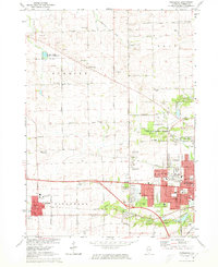
1971 Map of Winnebago
USGS Topo · Published 1973About this map
The village of Winnebago and the burgeoning western outskirts of Rockford define this 1970s landscape, showing the transition from rural agricultural land to suburban expansion. The western portion of the map is dominated by the townships of Burritt and Winnebago, where small crossroads like Wempletown and scattered institutions such as Burritt Center Sch anchor the farming community. Farther east, the urban grid of Rockford pushes toward the Anna R Page Forest Preserve, featuring a dense concentration of schools like Auburn High Sch and Woodrow Wilson Jr High Sch.
Find a feature on this map
64 named features on this map. Tap any name to fly to it.
Don’t see what you’re looking for? This feature index may not catch every label — zoom into the map to look around manually.
Map Details
Editions of this 1971 Winnebago Map
2 editions found
Other maps of this area

1917 · Kings
USGS Topo · 1:62,500

1918 · Rockford
USGS Topo · 1:62,500

1918 · Kings
USGS Topo · 1:62,500

1922 · Oregon
USGS Topo · 1:62,500

1924 · Oregon
USGS Topo · 1:62,500

1932 · Pecatonica
USGS Topo · 1:62,500

1936 · Pecatonica
USGS Topo · 1:62,500

1938 · Rockford
USGS Topo · 1:62,500

1949 · Camp Grant
USGS Topo · 1:24,000

1949 · Rockford
USGS Topo · 1:24,000