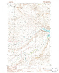
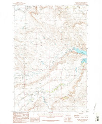
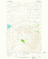
1986 Map of Winnett South
USGS Topo · Published 1986About this map
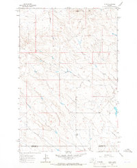
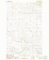
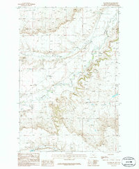
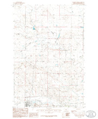
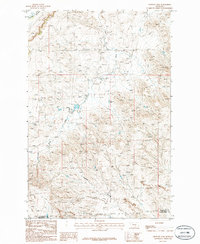
Winnett anchors the northern edge of this 1980s landscape, serving as a gateway to the complex water systems of Petroleum County. The map captures a high-elevation prairie terrain defined by the winding paths of Mc Donald Creek and Flatwillow Creek. Significant hydrological features such as Petrolia Lake dominate the eastern section, where the reservoir collects waters from the surrounding drainage basins. This mid-1980s provisional study illustrates a rugged cattle-country geography, where the land is carved by several major drainages including Elk Creek, Yellow Water Creek, and Alkali Creek. A solitary Gravel Pit indicates localized resource extraction amidst the extensive topography of ridges and coulees that characterize the region south of the townsite.
Find a feature on this map
9 named features on this map. Tap any name to fly to it.
Don’t see what you’re looking for? This feature index may not catch every label — zoom into the map to look around manually.
Map Details
Editions of this 1986 Winnett South Map
2 editions found
Other maps of this area

1954 · Roundup
USGS Topo · 1:250,000

1954 · Lewistown
USGS Topo · 1:250,000

1958 · Roundup
USGS Topo · 1:250,000

1959 · Lewistown
USGS Topo · 1:250,000
1963 · Kelley
USGS Topo · 1:24,000
1963 · Petrolia Lake
USGS Topo · 1:24,000
1986 · Ingals Dam
USGS Topo · 1:24,000
1986 · Flatwillow
USGS Topo · 1:24,000
1986 · Winnett North
USGS Topo · 1:24,000
1986 · Crowley Dam
USGS Topo · 1:24,000