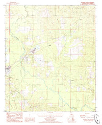
1984 Map of Winnfield East
USGS Topo · Published 1985About this map
The eastern edge of Winnfield and the timber-heavy landscape of Winn Parish are recorded here during the early 1980s. The Dugdemona River meanders through the western portion of the map, flanked by several smaller settlements that define the local economy and geography. Joyce appears as a significant hub near the river, while smaller named localities like Menefee, Creosote, and Colgrade are scattered through the wooded terrain.
Find a feature on this map
25 named features on this map. Tap any name to fly to it.
Don’t see what you’re looking for? This feature index may not catch every label — zoom into the map to look around manually.
Map Details
Editions of this 1984 Winnfield East Map
This is the sole edition of this map. No revisions or reprints were ever made.
Other maps of this area

1949 · Jonesboro
USGS Topo · 1:62,500

1950 · Jonesboro
USGS Topo · 1:62,500

1950 · Winnfield
USGS Topo · 1:62,500

1951 · Winnfield
USGS Topo · 1:62,500

1953 · Alexandria
USGS Topo · 1:250,000

1954 · Sikes
USGS Topo · 1:62,500

1954 · Tullos
USGS Topo · 1:62,500

1955 · Shreveport
USGS Topo · 1:250,000

1955 · Alexandria
USGS Topo · 1:250,000

1956 · Shreveport
USGS Topo · 1:250,000