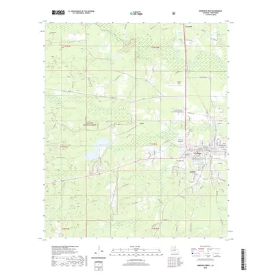
2020 Map of Winnfield West
USGS Topo · Published 2020About this map
The Winn Parish Courthouse stands as a central landmark in Winnfield, a town defined by its intersection of regional transport and forestry history. This 2020 survey details the transition from the dense woodlands of the Kisatchie National Forest in the west to the municipal grid and nearby settlements like Hatfield and Carla. Local history is preserved in numerous burial grounds, including Crockett Cem and Winnfield Cem, while the Dugdemona River and its tributaries like Sonnett Cr and Port de Luce Cr dictate the drainage patterns across the parish. The map also records modern educational and aviation infrastructure, such as the Central Louisiana Technical Community College Huey P Long Campus and the David G Joyce Airport, providing a comprehensive view of the area's current development within its traditional timberland setting.
Find a feature on this map
127 named features on this map. Tap any name to fly to it.
Don’t see what you’re looking for? This feature index may not catch every label — zoom into the map to look around manually.
Map Details
Editions of this 2020 Winnfield West Map
This is the sole edition of this map. No revisions or reprints were ever made.
Other maps of this area

1947 · Goldonna
USGS Topo · 1:62,500

1949 · Calvin SE
USGS Topo · 1:31,680

1949 · Calvin NE
USGS Topo · 1:31,680

1949 · Jonesboro
USGS Topo · 1:62,500

1950 · Jonesboro
USGS Topo · 1:62,500

1950 · Winnfield
USGS Topo · 1:62,500

1951 · Winnfield
USGS Topo · 1:62,500

1953 · Alexandria
USGS Topo · 1:250,000

1955 · Shreveport
USGS Topo · 1:250,000

1955 · Alexandria
USGS Topo · 1:250,000