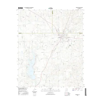
2016 Map of Winnsboro
USGS Topo · Published 2016About this map
Winnsboro serves as the central hub for this corner of East Texas, where the boundaries of Hopkins, Franklin, and Wood Counties converge. The city's street grid is clearly defined, with major thoroughfares like E Broadway St and N Main St forming the commercial heart. To the southwest, the expansive Lake Winnsboro dominates the landscape, its irregular shoreline punctuated by numerous inlets where Big Sandy Creek and Little Sandy Creek drain into the basin. This hydrology is a defining characteristic of the area, as the terrain is carved by a dense network of streams including Indian Creek, Briary Creek, and Crooked Creek. Genealogists and local historians can locate several significant sites, such as Lee Cem and McGee Cem, which provide tangible links to the community's past generations. The Winnsboro Municipal Airport and small bodies of water like Railroad Pool further illustrate the mix of modern infrastructure and rural land use.
Find a feature on this map
121 named features on this map. Tap any name to fly to it.
Don’t see what you’re looking for? This feature index may not catch every label — zoom into the map to look around manually.
Map Details
Editions of this 2016 Winnsboro Map
This is the sole edition of this map. No revisions or reprints were ever made.
Other maps of this area

1953 · Texarkana
USGS Topo · 1:250,000

1956 · Texarkana
USGS Topo · 1:250,000

1956 · Tyler
USGS Topo · 1:250,000

1960 · Winnsboro
USGS Topo · 1:24,000

1960 · Cartwright
USGS Topo · 1:24,000

1960 · Newsome
USGS Topo · 1:24,000

1960 · Rhonesboro
USGS Topo · 1:24,000

1960 · Pleasant Grove
USGS Topo · 1:24,000

1960 · Quitman
USGS Topo · 1:24,000

1964 · Como
USGS Topo · 1:24,000