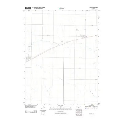
2009 Map of Winona
USGS Topo · Published 2009About this map
Winona serves as the primary hub of this high plains landscape, situated alongside the transit corridor defined by Hooker Ave. The surrounding terrain is primarily agricultural, punctuated by drainage systems like Middle Branch Hackberry Creek to the north and Sixmile Creek to the southeast. To the northeast, the small settlement of Page City is positioned near the Page Cemetery, while the larger Winona Cemetery lies just northwest of the main town. Local infrastructure is reflected in specialized features such as the Keller Brothers Landing Strip, indicating the vast distances and aviation-dependence of the region. The map also captures numerous section-line roads and named rural tracks, including 8th St and 3rd St, which provide a clear view of the organized land distribution in Logan County during the early 21st century.
Find a feature on this map
20 named features on this map. Tap any name to fly to it.
Don’t see what you’re looking for? This feature index may not catch every label — zoom into the map to look around manually.
Map Details
Editions of this 2009 Winona Map
This is the sole edition of this map. No revisions or reprints were ever made.
Other maps of this area

1954 · Goodland
USGS Topo · 1:250,000

1955 · Scott City
USGS Topo · 1:250,000

1956 · Goodland
USGS Topo · 1:250,000

1957 · Goodland
USGS Topo · 1:250,000

1958 · Scott City
USGS Topo · 1:250,000

1969 · Mc Allaster SE
USGS Topo · 1:24,000

1969 · Russell Springs 2 NE
USGS Topo · 1:24,000

1969 · Mc Allaster NE
USGS Topo · 1:24,000

1972 · Russell Springs
USGS Topo · 1:24,000

1972 · Monument
USGS Topo · 1:24,000