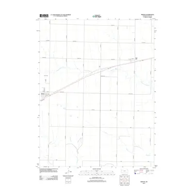
2012 Map of Winona
USGS Topo · Published 2012About this map
Winona serves as the primary hub of this Logan County landscape, centered at the junction of the railroad and local thoroughfares like Bellview Ave and Front St. The town's civic core is anchored by its Po and the residential blocks of Apache Acre, while the surrounding High Plains terrain is meticulously partitioned by a grid of section-line roads. This geometry is broken only by the wandering paths of Middle Br Hackberry Cr, Sixmile Cr, and W Spring Cr. Further east, Page City appears as a smaller rail-side settlement, mirroring the regional pattern of development tied to the transportation corridor. Local heritage is preserved at the Winona Cem and Page Cem, which provide essential points of reference for genealogists researching families from this corner of western Kansas.
Find a feature on this map
30 named features on this map. Tap any name to fly to it.
Don’t see what you’re looking for? This feature index may not catch every label — zoom into the map to look around manually.
Map Details
Editions of this 2012 Winona Map
This is the sole edition of this map. No revisions or reprints were ever made.
Other maps of this area

1954 · Goodland
USGS Topo · 1:250,000

1955 · Scott City
USGS Topo · 1:250,000

1956 · Goodland
USGS Topo · 1:250,000

1957 · Goodland
USGS Topo · 1:250,000

1958 · Scott City
USGS Topo · 1:250,000

1969 · Mc Allaster SE
USGS Topo · 1:24,000

1969 · Russell Springs 2 NE
USGS Topo · 1:24,000

1969 · Mc Allaster NE
USGS Topo · 1:24,000

1972 · Russell Springs
USGS Topo · 1:24,000

1972 · Monument
USGS Topo · 1:24,000