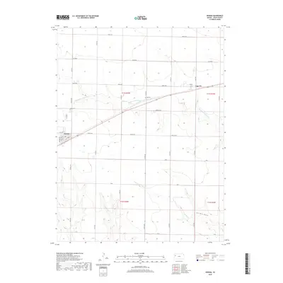
2018 Map of Winona
USGS Topo · Published 2018About this map
Winona and the small community of Page City anchor this high plains landscape of Logan County, Kansas. The map documents a grid of local corridors like Apache Acre, Day Dream, and Cedar Crst that crisscross the prairie, reflecting the modern management of vast agricultural tracts. For those tracing local heritage, the inclusion of Winona Cem and Page Cem provides exact locations for significant community landmarks. The terrain is defined by the subtle drainage patterns of Middle Br Hackberry Cr and Sixmile Cr, which eventually lead to Six Mile Gulch in the southeastern portion of the quadrangle. Streets such as Hooker Ave and Wilson Ave reveal the town structure of Winona during this contemporary era of the Great Plains.
Find a feature on this map
36 named features on this map. Tap any name to fly to it.
Don’t see what you’re looking for? This feature index may not catch every label — zoom into the map to look around manually.
Map Details
Editions of this 2018 Winona Map
This is the sole edition of this map. No revisions or reprints were ever made.
Other maps of this area

1954 · Goodland
USGS Topo · 1:250,000

1955 · Scott City
USGS Topo · 1:250,000

1956 · Goodland
USGS Topo · 1:250,000

1957 · Goodland
USGS Topo · 1:250,000

1958 · Scott City
USGS Topo · 1:250,000

1969 · Mc Allaster SE
USGS Topo · 1:24,000

1969 · Russell Springs 2 NE
USGS Topo · 1:24,000

1969 · Mc Allaster NE
USGS Topo · 1:24,000

1972 · Russell Springs
USGS Topo · 1:24,000

1972 · Monument
USGS Topo · 1:24,000