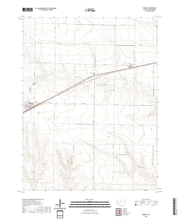
2022 Map of Winona
USGS Topo · Published 2022About this map
Winona stands as a primary focal point in this portion of Logan County, characterized by a grid of named streets including Degreere Ave, Hawley Ave, and Front St. To the east, the smaller settlement of Page City sits along the transit corridor, while the surrounding High Plains landscape is defined by the ephemeral drainages of Middle Br Hackberry Cr and Sixmile Cr. Local history is anchored by the Winona Cem and Page City Cem, providing important landmarks for genealogical research in this rural expanse. The map illustrates a developed network of section-line roads, such as Co Rd 250 and Co Rd 260, interspersed with named tracks like Eagle Eye and Apache Acre. In the southern reaches, the terrain drops into Six Mile Gulch, highlighting the subtle but important topography of the W-Spring Cr watershed.
Find a feature on this map
36 named features on this map. Tap any name to fly to it.
Don’t see what you’re looking for? This feature index may not catch every label — zoom into the map to look around manually.
Map Details
Editions of this 2022 Winona Map
This is the sole edition of this map. No revisions or reprints were ever made.
Other maps of this area

1954 · Goodland
USGS Topo · 1:250,000

1955 · Scott City
USGS Topo · 1:250,000

1956 · Goodland
USGS Topo · 1:250,000

1957 · Goodland
USGS Topo · 1:250,000

1958 · Scott City
USGS Topo · 1:250,000

1969 · Mc Allaster SE
USGS Topo · 1:24,000

1969 · Russell Springs 2 NE
USGS Topo · 1:24,000

1969 · Mc Allaster NE
USGS Topo · 1:24,000

1972 · Russell Springs
USGS Topo · 1:24,000

1972 · Monument
USGS Topo · 1:24,000