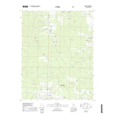
2017 Map of Winona
USGS Topo · Published 2017About this map
Winona stands as the primary hub in this corner of Shannon County, surrounded by the wooded hills of the Mark Twain National Forest. The landscape is defined by an intricate network of narrow valleys and hollows, including Pleasant Valley and Black Valley, carved by drainages like Shawnee Creek and Sycamore Creek. Near the small settlement of Munsell, the Munsell Spring and Church Pond provide notable water sources in an otherwise dissected upland terrain. Genealogists and local historians will find family and community landmarks such as Pine Lawn Cemetery near Winona and Williams Cemetery to the east. The presence of Lewis Lake and numerous named hollows like Abe and Millman Hollow suggests a long history of local land naming tied to specific families and timber-era geography, while the proximity of the Peck Ranch Road indicates the managed wilderness character of the region.
Find a feature on this map
76 named features on this map. Tap any name to fly to it.
Don’t see what you’re looking for? This feature index may not catch every label — zoom into the map to look around manually.
Map Details
Editions of this 2017 Winona Map
This is the sole edition of this map. No revisions or reprints were ever made.
Other maps of this area

1915 · Eminence
USGS Topo · 1:62,500

1917 · Eminence
USGS Topo · 1:62,500

1928 · Cardareva
USGS Topo · 1:62,500

1931 · Bandyville
USGS Topo · 1:48,000

1944 · Van Buren
USGS Topo · 1:62,500

1944 · Birch Tree
USGS Topo · 1:62,500

1946 · Van Buren
USGS Topo · 1:62,500

1948 · Birch Tree
USGS Topo · 1:62,500

1949 · Rolla
USGS Topo · 1:250,000

1949 · Cardareva
USGS Topo · 1:62,500