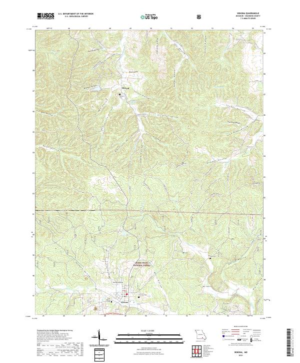
2021 Map of Winona
USGS Topo · Published 2021About this map
Winona anchors the southern portion of this Ozark landscape, where the settlement pattern is deeply influenced by a complex system of valleys and hollows. The area is defined by its water resources, from the Munsell Spring near the small settlement of Munsell to the larger flows of Sycamore Cr and Pike Cr. Much of the terrain falls within the Mark Twain National Forest, reflecting the heavily forested and dissected nature of the hills. Local genealogy is well-preserved through several scattered burial grounds, including the Old Baptist Cem and Pine Lawn Cem near the town center, and the more remote Williams Cem to the east. The map reveals how modern infrastructure like State Hwy H and State Hwy F follows the high ground between extensive drainage systems like Kleipzig Hollow and Blackroot Hollow.
Find a feature on this map
69 named features on this map. Tap any name to fly to it.
Don’t see what you’re looking for? This feature index may not catch every label — zoom into the map to look around manually.
Map Details
Editions of this 2021 Winona Map
This is the sole edition of this map. No revisions or reprints were ever made.
Other maps of this area

1915 · Eminence
USGS Topo · 1:62,500

1917 · Eminence
USGS Topo · 1:62,500

1928 · Cardareva
USGS Topo · 1:62,500

1931 · Bandyville
USGS Topo · 1:48,000

1944 · Van Buren
USGS Topo · 1:62,500

1944 · Birch Tree
USGS Topo · 1:62,500

1946 · Van Buren
USGS Topo · 1:62,500

1948 · Birch Tree
USGS Topo · 1:62,500

1949 · Rolla
USGS Topo · 1:250,000

1949 · Cardareva
USGS Topo · 1:62,500