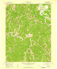
1957 Map of Winslow
USGS Topo · Published 1959About this map
The Guyandotte River winds through the northern portion of this late 1950s survey, where the Chesapeake and Ohio River railroad line follows the riverbank past Owens Crossing. The landscape is defined by the sharp transition between the river valley and the deeply dissected hills of the McComas and Union districts. The settlement pattern is strictly tied to the hollows and creek beds, with rural landmarks like Winslow and Sarah serving as local hubs.
Find a feature on this map
58 named features on this map. Tap any name to fly to it.
Don’t see what you’re looking for? This feature index may not catch every label — zoom into the map to look around manually.
Map Details
Editions of this 1957 Winslow Map
2 editions found
Other maps of this area

1892 · Huntington
USGS Topo · 1:125,000

1898 · Huntington
USGS Topo · 1:125,000

1901 · Guyandot
USGS Topo · 1:62,500

1902 · Guyandot
USGS Topo · 1:62,500

1902 · Milton
USGS Topo · 1:62,500

1902 · Midkiff
USGS Topo · 1:62,500

1907 · Midkiff
USGS Topo · 1:62,500

1909 · Wayne
USGS Topo · 1:62,500

1909 · Midkiff
USGS Topo · 1:62,500

1931 · Wayne
USGS Topo · 1:62,500