
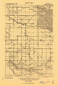
1919 Map of Winsor
USGS Topo · Published 1919About this map
The Red Lake Indian Reservation boundary defines much of the eastern landscape on this 1919 survey, illustrating the intersection of sovereign tribal lands and early twentieth-century rural development. Small agrarian settlements such as Winsor, Wanke, and Griebrok are scattered across a territory undergoing extensive hydraulic modification. The proliferation of drainage projects, including Jud. Ditch No. 1 & No. 3 and Judicial Ditch No. 4, indicates a concerted effort to reclaim marshy terrain for agriculture.
Find a feature on this map
37 named features on this map. Tap any name to fly to it.
Don’t see what you’re looking for? This feature index may not catch every label — zoom into the map to look around manually.
Map Details
Editions of this 1919 Winsor Map
2 editions found
Other maps of this area

1918 · Jelle
USGS Topo · 1:62,500

1919 · Fosston
USGS Topo · 1:62,500

1919 · Grit
USGS Topo · 1:62,500

1919 · Churnes
USGS Topo · 1:62,500

1943 · Bagley
USGS Topo · 1:62,500

1954 · Bemidji
USGS Topo · 1:250,000

1954 · Roseau
USGS Topo · 1:250,000

1957 · Roseau
USGS Topo · 1:250,000

1957 · Bemidji
USGS Topo · 1:250,000

1958 · Bemidji
USGS Topo · 1:250,000