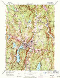
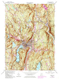
1956 Map of Winsted
USGS Topo · Published 1971About this map
Winsted serves as the central hub of this mid-century survey, its urban core concentrated along the Mad River and Still River. The surrounding landscape is defined by its recreation and conservation areas, including the expansive Highland Lake with its three distinct bays—First Bay, Second Bay, and Third Bay—and numerous summer retreats like Camp Delaware and Camp Sequassen. The settlement pattern follows the river valleys and ancient transport routes, such as the Old North Road, which connects the mountain hamlets of Colebrook and Riverton.
Find a feature on this map
84 named features on this map. Tap any name to fly to it.
Don’t see what you’re looking for? This feature index may not catch every label — zoom into the map to look around manually.
Map Details
Editions of this 1956 Winsted Map
7 editions found
Other maps of this area

1887 · Granville
USGS Topo · 1:62,500

1888 · Sandisfield
USGS Topo · 1:62,500

1889 · Granville
USGS Topo · 1:62,500

1892 · Winsted
USGS Topo · 1:62,500

1892 · Granby
USGS Topo · 1:62,500

1893 · Granville
USGS Topo · 1:62,500

1893 · Sandisfield
USGS Topo · 1:62,500

1895 · Granville
USGS Topo · 1:62,500

1896 · Holyoke
USGS Topo · 1:125,000

1897 · Sandisfield
USGS Topo · 1:62,500