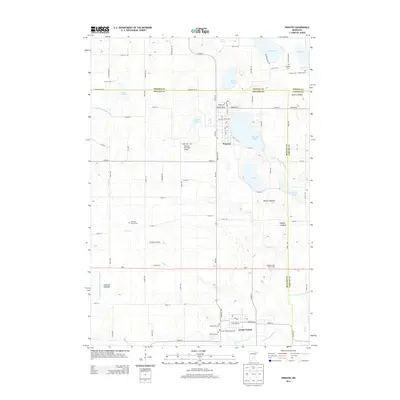
2013 Map of Winsted
USGS Topo · Published 2013About this map
Winsted and Lester Prairie anchor this section of the Minnesota prairie, situated at a tripartite boundary where Wright, McLeod, and Carver Counties meet. The landscape is a complex network of glacial lakebeds and active waters, including Winsted Lake, Butler Lake, and the meandering S Fork Crow River. The map provides significant genealogical value through its detailed labeling of numerous burial grounds such as Holy Trinity Cem, Nylunda Cem, and the Swedish Cem.
Find a feature on this map
87 named features on this map. Tap any name to fly to it.
Don’t see what you’re looking for? This feature index may not catch every label — zoom into the map to look around manually.
Map Details
Editions of this 2013 Winsted Map
This is the sole edition of this map. No revisions or reprints were ever made.
Other maps of this area

1953 · Saint Paul
USGS Topo · 1:250,000

1953 · New Ulm
USGS Topo · 1:250,000

1953 · Saint Cloud
USGS Topo · 1:250,000

1953 · Stillwater
USGS Topo · 1:250,000

1955 · Stillwater
USGS Topo · 1:250,000

1957 · Saint Cloud
USGS Topo · 1:250,000

1957 · New Ulm
USGS Topo · 1:250,000

1957 · Waconia
USGS Topo · 1:62,500

1958 · New Ulm
USGS Topo · 1:250,000

1958 · Stillwater
USGS Topo · 1:250,000
Featured Places
- Winsted, MN
- Lester Prairie, MN
- Parkview Mobile Home Park, Lester Prairie
- Hollywood Township, MN
- Victor Township, MN