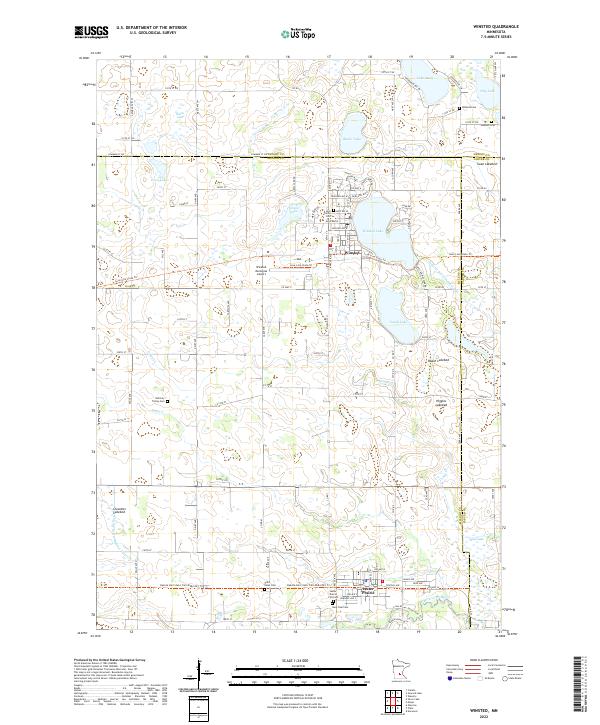
2022 Map of Winsted
USGS Topo · Published 2022About this map
Winsted and Lester Prairie serve as the primary hubs of this agricultural and wetland landscape at the intersection of McLeod, Wright, and Carver counties. The area is defined by a dense network of glacial basins and drainage systems, including the S Fork Crow River and numerous lakes such as Winsted Lake, South Lake, and Lake Mary. Historical land use is visible in the presence of several lakebeds, including Roach Lakebed, Higgins Lakebed, and Cloustier Lakebed, indicating a landscape in a state of long-term hydrological transition.
Find a feature on this map
72 named features on this map. Tap any name to fly to it.
Don’t see what you’re looking for? This feature index may not catch every label — zoom into the map to look around manually.
Map Details
Editions of this 2022 Winsted Map
This is the sole edition of this map. No revisions or reprints were ever made.
Other maps of this area

1953 · Saint Paul
USGS Topo · 1:250,000

1953 · New Ulm
USGS Topo · 1:250,000

1953 · Saint Cloud
USGS Topo · 1:250,000

1953 · Stillwater
USGS Topo · 1:250,000

1955 · Stillwater
USGS Topo · 1:250,000

1957 · Saint Cloud
USGS Topo · 1:250,000

1957 · New Ulm
USGS Topo · 1:250,000

1957 · Waconia
USGS Topo · 1:62,500

1958 · New Ulm
USGS Topo · 1:250,000

1958 · Stillwater
USGS Topo · 1:250,000