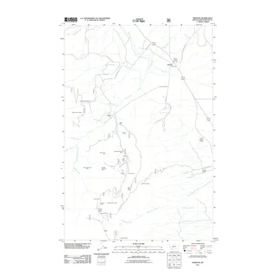
2011 Map of Winston
USGS Topo · Published 2011About this map
Mining operations dominate the rugged slopes of Broadwater County in this early 21st-century record, where the small community of Winston serves as a lone hub along the highway. The landscape is a dense network of historical claims and active sites, featuring the East Pacific Mine, Kleinschmidt Mine, and Monte Cristo Mine tucked into the drainages of Weasel Creek and Beaver Creek. These workings, along with family names at Whitehead Ranch, speak to a legacy of extraction that has shaped the local economy for over a century.
Find a feature on this map
39 named features on this map. Tap any name to fly to it.
Don’t see what you’re looking for? This feature index may not catch every label — zoom into the map to look around manually.
Map Details
Editions of this 2011 Winston Map
This is the sole edition of this map. No revisions or reprints were ever made.
Other maps of this area

1886 · Fort Logan
USGS Topo · 1:250,000

1948 · White Sulphur Springs
USGS Topo · 1:250,000

1950 · Canyon Ferry
USGS Topo · 1:62,500

1950 · Townsend
USGS Topo · 1:62,500

1950 · East Helena
USGS Topo · 1:62,500

1950 · Clancy
USGS Topo · 1:62,500

1958 · White Sulphur Springs
USGS Topo · 1:250,000

1961 · White Sulphur Springs
USGS Topo · 1:250,000

1965 · White Sulphur Springs
USGS Topo · 1:250,000
1972 · Canyon Ferry SW
USGS Topo · 1:24,000